Editor’s Brief
Last Week we looked at Helsing, a major player in the growing NATO ecosystem. CEO of Nordic Air Defense recently claimed, “Investing in defense was worse than porn sites.” (Article from the Wall Street Journal)
This week we’re looking at Theseus, a company building an alternative to GPS navigation.
As always, your feedback shapes our coverage. Reply directly with insights or questions.

Signal Brief: Theseus — Fighting When GPS Goes Dark
Theseus is building a GPS-free Visual Navigation System (VNS) that enables autonomous drone operation in environments where GPS is jammed or unavailable. Within DoD’s modernization priorities, Theseus addresses Assured PNT (Positioning, Navigation, and Timing) by providing navigation resilience that cannot be lost to jamming or spoofing.
Origins & Vision
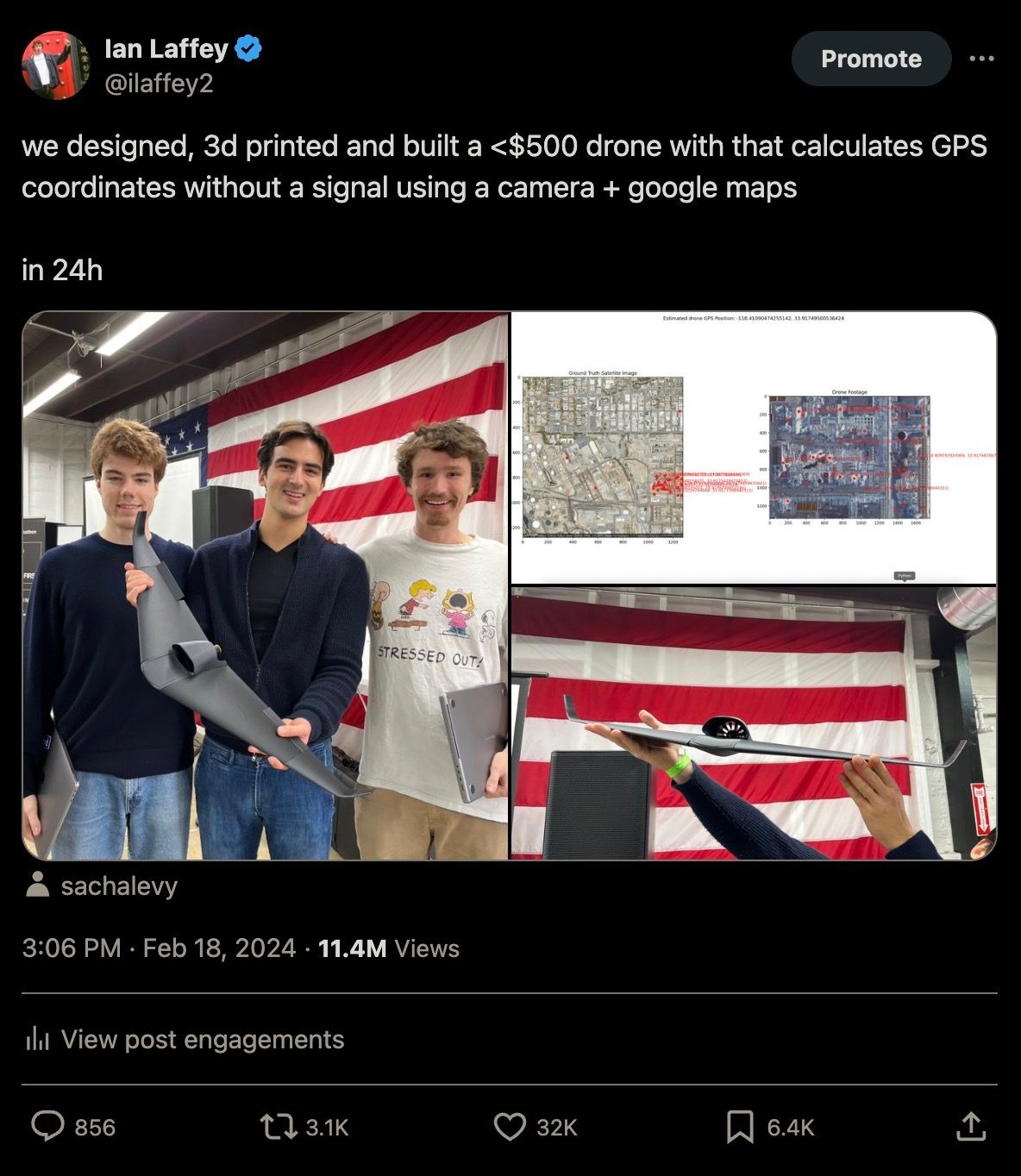
Founded in early 2024, Theseus began as an impromptu project at an El Segundo hackathon event. Carl Schoeller, Sacha Lévy, and Ian Laffey designed, 3D-printed, and assembled a GPS-independent drone in under 24 hours, using the drone’s camera and cached Google satellite maps to navigate without any GPS signal.
Two weeks later, Theseus was accepted into Y Combinator's Spring 2024 cohort, and by August 2024, had delivered its first units to U.S. Army Special Operations Command (SOCOM) for testing in training exercises.
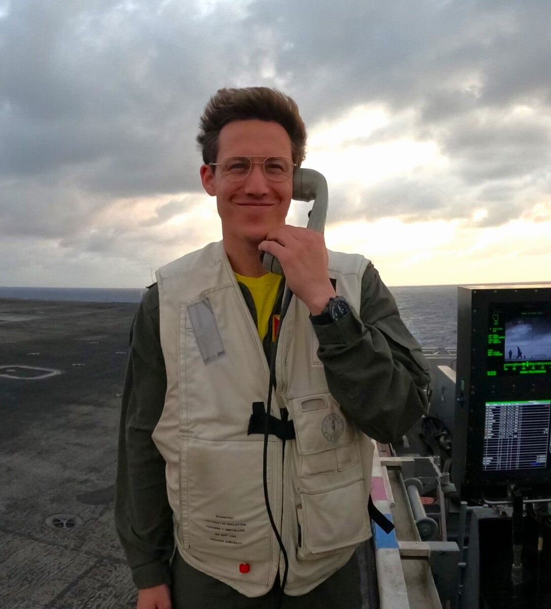
CEO Ian Laffey summarized the company’s mission clearly:
There are good dudes getting killed everyday and we can actually prevent that… It’s not our job to get in a trench, it’s not our job to get in a fox hole. We should go as close as possible to that and help those people as much as possible.
Key Takeaways
GPS Denial is Operational Reality: Electronic warfare has made GPS jamming a daily operational constraint
Visual Navigation Closes the Gap: Computer vision-based positioning offers jam-proof navigation, eliminating the RF emissions required by traditional alternatives.
Retrofit Accelerates Fielding: As a plug-and-play module compatible with existing autopilots, Theseus can integrate without major software overhauls
Speed Meets Urgency: Seven-month progression from hackathon prototype to Special Forces field testing
Tech Radar:
Traditional non-GPS approaches that rely on accelerometers and gyroscopes accumulate drift, resulting in potentially hundreds of meters of position error after minutes of flight.
Theseus Visual Positioning System (VPS) eliminates this drift by continuously comparing live camera imagery against cached satellite maps, providing absolute position fixes that reset accumulated inertial errors.
The module mounts to the aircraft with a downward camera view, connects to the autopilot’s GPS input port, and draws aircraft power.
Key Capabilities
Small SWaP: Weighs <300 grams, roughly the volume of a smartphone.
Autopilot Integration: Outputs a standard GPS signal (NMEA protocol) for plug-and-play installation with no software modification or recertification needed.
Edge Processing: Executes optimized algorithms on low-power processors onboard the aircraft.
Zero RF Emissions: Operates as a fully passive system, producing no detectable transmissions.
Technical Implementation Considerations
The system depends on visual feature recognition, which performs best over terrain with distinctive features (roads, rivers, buildings, vegetation). Performance drops over featureless environments such as open ocean or uniform desert, and visual obstruction (fog, clouds, smoke) can degrade reliability.
During these gaps, the onboard IMU maintains position estimates through dead reckoning until visual reacquisition.
Theseus has optimized its algorithms for military UAS profiles, handling varying altitudes, gimbal or fixed cameras, and challenging lighting conditions. Map updates can be loaded pre-mission using recent satellite imagery for the target area.
Market Signals
Funding & Growth
Total Funding: $4.8M across 2 rounds
Latest Round: $4.3M Seed Round (April 2025)
Notable Investors: First Round Capital, Y Combinator, Lux Capital Pioneed Fund
Contracts & Government Traction
SOCOM: Delivered prototypes for field testing (August 2024)
Manufacturer LOIs: Multiple drone manufacturers have issued letters of intent to integrate Theseus Micro VPS.
Ukraine Operations: Active collaboration with frontline Ukrainian forces over the past year for rapid iteration and field updates.
Looking Ahead
No single system can be guaranteed for 100% for 100% of the time. Possible exclusive reliance on GPS and its augmentations, combined with other complex interdependencies, raises the potential for “singlepoint failure” and “cascading effects.”
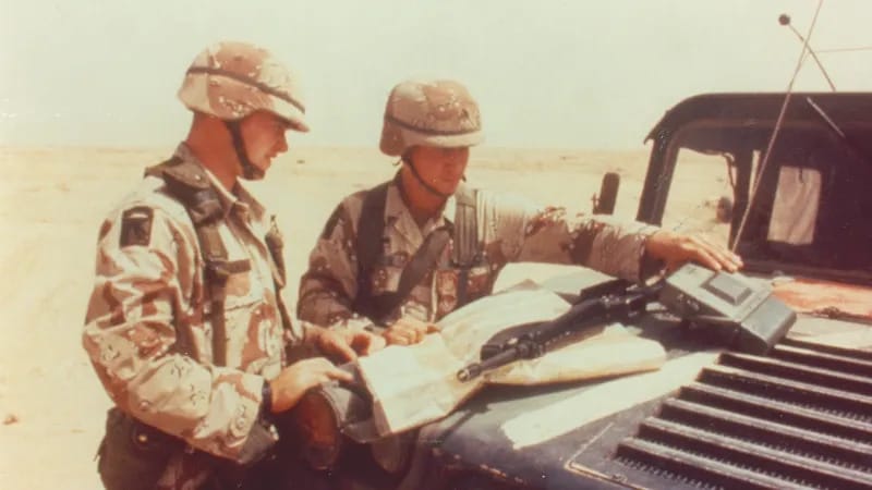
The First Gulf War was GPS’s debut as a warfighting tool. Even before the constellation was fully operational, coalition forces used it to move across Kuwait and Iraq with unprecedented speed and precision. But the war also exposed its weakness: crude Iraqi jammers were able to partially degrade the signal, slowing the advance.

Soldiers operate the small lightweight GPS receivers during Operation Desert Storm: Photo credit U.S. Army/DVIDS
Three decades later, jamming, spoofing, and denial are table stakes. In Ukraine, each side continues layering antennas, jammers, software, and AI filters in a constant race to stay connected to the sky.
China has BeiDou. Russia has GLONASS. Either could decide, in a crisis, that taking down America’s operating system is worth the global chaos it would trigger across finance, energy, and logistics.
In a great-power war, that may be a price they’re willing to pay.
The truth is, we’ve forgotten how to navigate without GPS. For most of human history, we didn’t need it. Land navigation was a core warfighting skill, and the stars were more than enough. When something becomes as ubiquitous as GPS, you stop maintaining the muscle memory to replace it.
That’s what makes Theseus interesting. They’re not building a better GPS receiver—they’re building a way to fight when GPS is gone. Their system integrates seamlessly with existing autopilots rather than forcing a proprietary architecture, which makes adoption faster and frictionless.
Will it work everywhere? No. Smoke, fog, and obscurants degrade camera performance. Featureless environments like desert, ocean, or snowfields reduce visual landmarks. And night operations require IR or thermal sensors instead of visible light cameras.
But layer enough modalities (optical, celestial, inertial) and you start to build a navigation network that can fight through serious GPS denial.
And that quote at the beginning? It came from the 1996 Presidential Commission on Critical Infrastructure Protection.
Challenges
Prototype-to-Production Transition – Converting early Special Operations interest into large-scale production contracts
Supply Chain and Manufacturing Scale – Small-batch prototype production to manufacturing thousands of units
Environmental Performance Limitations – Adverse weather, night operations, or featureless environments may limit effectiveness, requiring additional sensor modes or redundancy layers.
Bottom Line:
We’re never going to eliminate our dependence on GPS. And quite frankly, we shouldn’t try to. The precision it brings to navigation, weapons, and timing is indispensable. The carpet bombing of WWII isn’t something any modern military or society would tolerate again.
But when GPS becomes the only system we train, fight, and navigate with, we create a fragile dependency that adversaries can exploit.
Theseus offers a path toward resilience. Today, their system integrates primarily with drones but the underlying technology could extend far beyond them. Expanding integration across other aviation platforms would introduce a badly needed layer of redundancy into modern air navigation and give us a chance if the satellites go down.
Stay Ahead of Defense Innovation
Not just because it’s content
But because the future is being built. And you want a seat at the table.
